


"They went in one rope team." What happened to Belarusians in the mountains of Kyrgyzstan
In early August, after ascending Kurumdy Peak in Kyrgyzstan, a group of three climbers went missing. Among them were two Belarusians: 43-year-old Maksim Palyanski and 60-year-old Mikalai Svirydau, as well as 37-year-old Siarhei Rubtsou from Lithuania. This search operation instantly attracted great attention: thousands of people followed the developments, although emergencies in the mountains occur regularly.
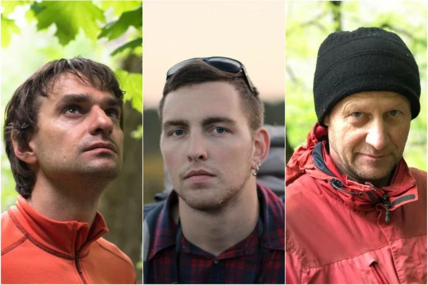
Why this particular story caused such a resonance, what could have happened to a very experienced team, and what is currently happening on site, Onliner was told by the search operation coordinator Aliaksandr Smirnou.
Chronology of events: many important details
The search team assumes that an emergency occurred with the climbers during their descent from Kurumdy Peak (at an altitude of 5400 meters).
On July 20, the group flew to Osh, obtained border permits, and reached the start of the route in the Kyzylsu gorge. The satellite phone never registered on the network at the location. All subsequent communication was via a mobile phone, which occasionally caught a signal on the ridge.
— All this time, the guys wrote where they were. On July 28, for example, they sent the coordinates of the first camp. But in the last message, they weren't there.
It was these data that we most lacked later: we were searching not at a specific point, but on a route several kilometers long with a two-and-a-half-kilometer altitude difference, — says Aliaksandr Smirnou.
— On August 1, at 10:30, all three reached the summit. That's a fact. On August 2, the last message arrived: they reported that they would be ready to leave on August 4 at 10:00. This means August 2 was the last day of communication. Two days later, the climbers still hadn't reached the car.
Further, the coordinator explains, two unknown factors emerged, due to which the search area turned out to be enormous.
The first was which exact path Maksim, Mikalai, and Siarhei took downwards.
— The trip was conceived as a circular one: after the summit, the group planned to traverse along the main ridge, through the eastern peaks of Kurumdy, and descend from the other side, not by the ascent route. This is a longer and more complex option, and they were preparing for it, — clarifies the interviewee.
— But time spoke against this version. On August 1, they wrote that they planned to descend to the base camp the next day, and only two days remained until the meeting with the car. This was clearly not enough for a traverse, especially since the group was already a day behind schedule during the ascent. This meant, most likely, they went down the same way they ascended. But "most likely" is not "certainly," and it was about people's lives. Therefore, both routes had to be surveyed.
According to Aliaksandr, everything the rescuers later discovered confirmed the first option (i.e., the longer and more complex route), but this only became clear on August 13.
And at that time, there was still one unknown point: from where exactly was that last message sent?
— The guys were sure that their phone was working on Chinese roaming. This sounded logical: the mountain stands at the junction of the borders of Kyrgyzstan, Tajikistan, and China, and from the ridge, a Chinese tower is "reached" more easily than a Kyrgyz one. That's what they said, and that's what we wrote in the first messages. When we started to sort it out with the operators, it turned out: the device registered on the Kyrgyz network.
— The difference here is not formal — it's again about where exactly to search. If messages were sent via a Chinese tower, it means they were sent high up, on the main ridge, where this signal is generally caught. Then on August 2, the group was still at the top, and priority should have been given to the upper part of the route. A Kyrgyz connection, however, does not impose such a condition: the signal could have passed lower — from the ascent or descent route.
While all this was being clarified, part of the first week was spent on a version that ultimately was not confirmed. And the first seven days in such an operation are the most valuable.
Yes, unfortunately, this is what searching looks like when there is no precise initial data. If they had sent coordinates in the message from August 2, even in one line, it would have cut the entire work by a week.
Nevertheless, by the evening of August 5, it finally became clear: a rescue operation needed to begin. The next day, August 6, the Belarusian Alpine Federation, through diplomatic channels, appealed to the Ministry of Emergency Situations of Kyrgyzstan with a request for assistance in the search for the athletes.
August 7. A rescue squad from the Ministry of Emergency Situations of Kyrgyzstan departed for the area and began surveying the terrain.
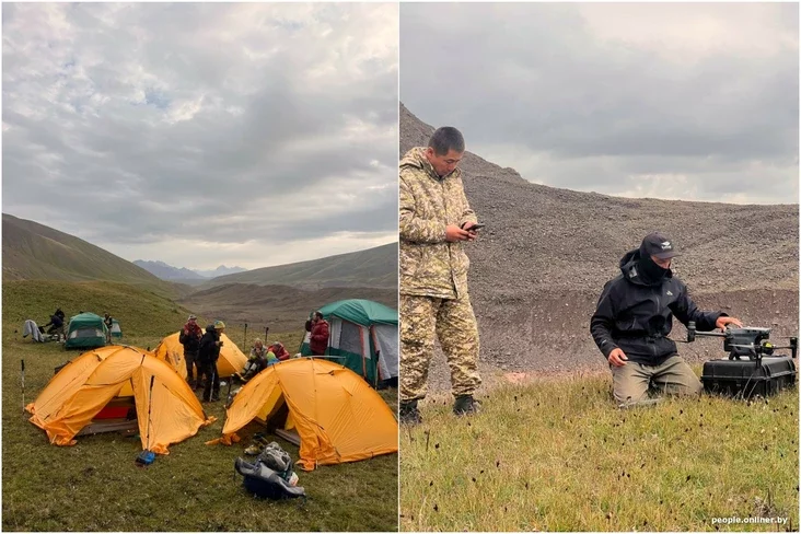
August 8. Swiss guide Damian, who had been in these parts a month before the incident, launched a drone to an altitude of 4300 meters and saw a tent in the base camp. There were no people nearby. Judging by the equipment, this was a depot left by the guys before their summit attempt. The finding highly likely confirmed: the group remained on the mountain.
August 8–11. A storm warning was announced in the Chong-Alay district of Kyrgyzstan; snow fell heavily in the mountains. On August 9, the squad resumed searching, surveying the side slopes with drones, but due to bad weather was forced to retreat. The ground operation temporarily stopped.
August 10–11. Professional drone operators joined the team. On August 11, a specialized DJI M30T with a thermal imager, 200x zoom, and a working altitude of up to 7000 meters was launched. Six flights were made during the day, but everything above 5000–5500 meters was tightly covered by clouds.
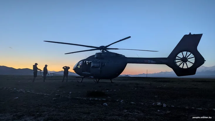
August 12. A helicopter was connected to the search for the first time. The aircraft did not ascend above 5500 meters due to thick fog. The critically important section between the second and third camps remained unexplored again.
August 13. The first full-fledged flying morning occurred: three helicopter flights and numerous drone launches. During the flight, a backpack and an orange jacket were spotted on the western side of the ridge (at an altitude of about 4500 meters), and nearby — individual items, apparently from the same luggage. Some of the findings that day were highlighted by computer vision algorithms.
August 14–15. These days were spent determining the trajectory of the fallen items and capturing key areas in high resolution. In parallel, volunteers assembled a digital 3D model of the mountain: they marked the discovered items, calculated fall lines, and a map of aerial coverage of the area.
— On the morning of August 16, while analyzing footage in the cone of snow-rock debris, near the previously found items, we saw what with a high probability are the bodies of the group members, — recalls Aliaksandr Smirnou. — On the same day, the weather deteriorated, flights stopped, and the camp began to be dismantled.
By the way, by the time the personal belongings of the climbers were found, rescuers and volunteers had received 141 video recordings: 107 gigabytes of data and more than 7 hours of footage. This is about 790 thousand frames plus 368 detailed photographs.
According to the coordinator, 12.8 square kilometers of mountain slope were captured in the footage. And from the shots of the discovery area itself, volunteers assembled a gigantic panorama with a resolution of 15.7 gigapixels.
— Every minute of material was reviewed multiple times: by people, two automatic detectors, and neural networks, — says Smirnou. — Recordings were analyzed by over a hundred volunteers from different countries, many of whom had never been to the mountains in their lives and learned to "read" the terrain from scratch in the evenings after work. 89 people sent 1146 frames with potential leads to the headquarters.
This is about a thousand person-hours in just a week — half a year's work of one person condensed into seven days.
At the same time, Aliaksandr emphasizes: everything that could be seen from the air was only possible thanks to the colossal work of those below.
— Rescuers from the Ministry of Emergency Situations of Kyrgyzstan and the Chong-Alay squad maintained a camp at an altitude of four thousand meters and handled the logistics of the last twelve kilometers from the road, where there are no paths or communication. Our generator and fuel were carried to the base camp by them. And residents of the villages of Sary-Tash and Sary-Mogul collected 65 liters of gasoline in just one day and volunteered to carry it up. Without this help, the drone simply would not have been able to fly.
What is known at this moment: facts and conclusions
Let's start with the facts. The group successfully reached its goal: on August 1 at 10:30, all three climbers stood on the summit.
This means, Aliaksandr Smirnou is convinced, the emergency occurred precisely during the descent.
Furthermore, according to specialists' observations, the items found starting from August 13 are not scattered, but lie along a single line on the slope. Along this same trajectory, at the foot of the stopped snow-rock mass, everything swept away by the avalanche accumulated. It was there, on August 16, that the bodies were seen.
Additionally, among the finds, a rope for a rope team was noticed, and further down the slope — personal belongings of all three group members.
— At the top, on the ridge at an altitude of about 5400 meters, a clear zone of fresh detachment is visible. Simply put, that very section of the slope from which the snow-rock mass originated, — explains Smirnou.
The discovered rope for a rope team indicates that, with a high degree of probability, the guys were moving in one rope team. For mountaineering, this is a key marker: people were connected to each other and moved together.
The fact that the belongings of all three lie in a single strip of the slope only confirms: the group did not split up during the descent.
No one fell behind, went down alone, or stayed at the top.
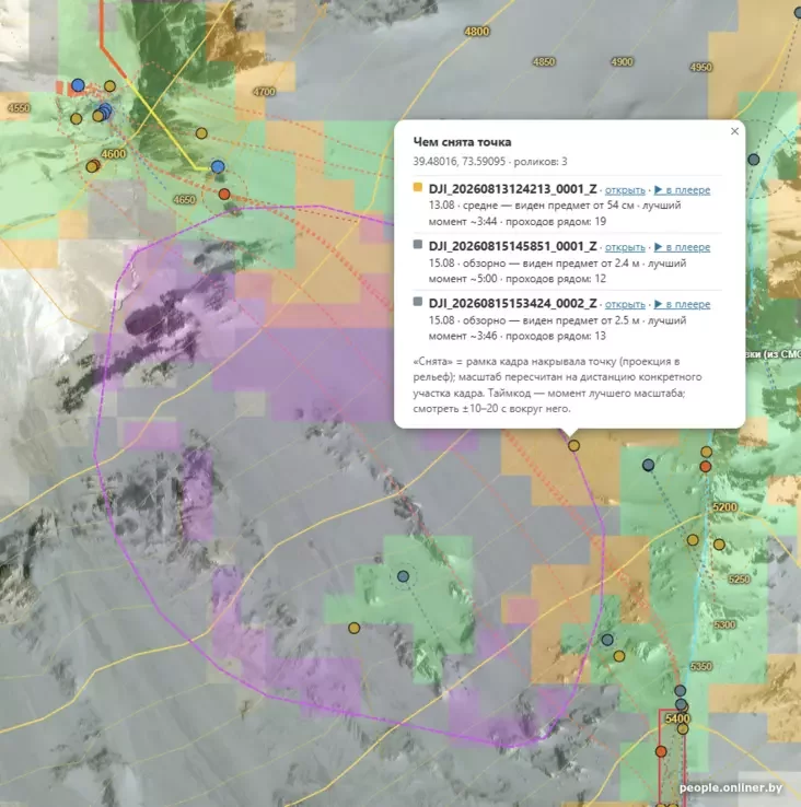
Here, Aliaksandr emphasizes, it is important to understand the geometry of the terrain: without it, the picture of the incident simply does not add up.
— The slope in this place acts like a giant funnel. Everything that broke off from the ridge falls down a single couloir and stops in one place — the debris cone, — explains Aliaksandr Smirnou.
— That's why the items lined up in a straight line, not scattered all over the mountain. For the same reason, we recalculated the fall corridor on the map daily to understand where to direct the drones. When we saw what we were looking for on August 16, the object was precisely in the sector that volunteers had been calculating all week. But here we need to be as precise as possible: this line shows where everything was carried, but it doesn't explain what exactly everything started with.
Simply put, there is no exact date when the emergency occurred, and most likely, there never will be. One thing is known for sure: on August 2, the climbers were alive and in contact. On August 4, a car was waiting for them — according to their own schedule, by this time they should have descended to the road.
This means the tragedy occurred sometime between August 2 and August 4. That is, earlier than they were expected at the base, and several days before the first rescuers reached the area.
Smirnou notes: the group's silence itself did not cause alarm: they had unstable communication even before. The alarm was raised not because of a lack of messages, but because the climbers did not reach the car. And it was physically impossible to start a search operation earlier.
As for the specific cause of the incident, it remains unknown. And it is unlikely to be clarified in the future.
— What generally happens on such terrain is clear even without experts: snow can slide from a steep slope, or a cornice, blown by the wind over a precipice, can collapse, or a foothold on steep ice can break. All of this takes seconds. None of these events requires anyone's fatal error: they are provoked by snow, wind, and slope. Something similar can happen to climbers of absolutely any qualification. What exactly happened to the group cannot be determined from the available materials.
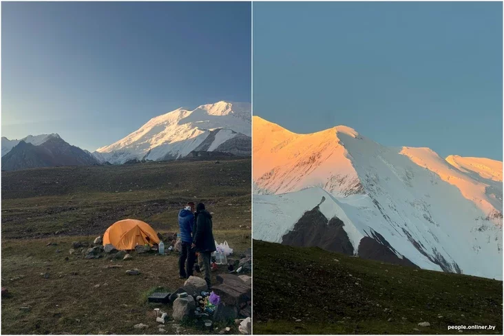
And there are several reasons for this, according to Aliaksandr. The main one is that by the time the active phase of the search began, the mountain was already heavily covered. Snowfalls occurred regularly from the beginning of the month, a storm warning was in effect in Kyrgyzstan from August 8 to 11, and fresh snow fell almost every night afterwards.
— We saw this with our own eyes in the images: items that were clearly visible on August 13 completely disappeared under the snow cover just a day later. Everything that could tell about the moment of the fall was erased before the first drone ascended to the area.
The footage shows the result, not the event itself. From a static picture, it's impossible to distinguish snow that slid with people from snow that slid on its own a week later. The detachment zone on the ridge could have formed on the day of the accident or much later — without any connection to the group. We mention it only because it's visible in the frames, not because we consider it the unambiguous cause.
And one more thing: experience in the mountains solves a lot, but it cannot negate either a falling rock from above or a sudden deterioration of the weather.
Maksim Palyanski and Mikalai Svirydau are both "Snow Leopards," having climbed all five seven-thousanders of the former USSR, including the most difficult Pobeda Peak. All three climbers had repeatedly gone together, and they had been preparing for the ascent of Kurumdy for months.
These were not lost tourists or people who didn't know something about the mountains. Kurumdy is a severe peak that British, Polish, and Czech expeditions failed to conquer in the nineties, and the first confirmed ascent there occurred only on October 12, 2001.
What was found on August 16 and why the climbers were presumed dead
We note immediately: the footage does not directly show human figures, as everything is hidden under a layer of snow and rock fragments. The only thing that could be seen in the drone recording was boots with crampons, parts of equipment, elements of clothing, as well as characteristic outlines under the snow, which the searchers identify as bodies.
One can speak with one hundred percent certainty only after a ground descent — then official identification will also be possible.
— On August 18, the Ministry of Emergency Situations of Kyrgyzstan reported that on the 16th, during search operations, climbers' footwear was found. Some media presented this as a refutation of our data. In fact, there is no dispute here, and I want to emphasize this, — explains Aliaksandr Smirnou.
— The Ministry of Emergency Situations spoke the truth: mountaineering boots with crampons are indeed the clearest fragment that can be seen in the recording. If one names only what can be 100% certain, then it is precisely footwear. We, however, added elements of clothing, equipment, and characteristic outlines to this detail, immediately clarifying: it is too early to draw final conclusions.
The difference between our wording and the Ministry of Emergency Situations' report is not in the facts, but in the degree of caution.
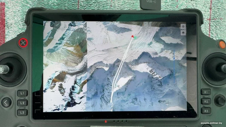
The search coordinator points out that no one has yet approached this point from the ground:
— This means that officially no one can confirm or deny the finding now — neither us nor state bodies. Accurate information will only be provided by the descent and subsequent identification. Until then, we do not name individuals or the number found, do not publish footage, and do not comment on the condition of the fragments.
Why was the group without a beacon?
— Aliaksandr, why were the climbers without a satellite beacon?
— I'll start with something many overlook. The group had a satellite phone, and this communication works in this area: with the same device and the same operator, I made a trek from the Kurumdy River towards Lenin Peak three years ago. However, the phone never registered on the network along the route. Why, we haven't established yet. As a hypothesis, one could assume that the guys were ascending from the north, outside the line of sight of the satellites. But they certainly did not have a personal autonomous tracker.
Here, says the interviewee, it is important to understand the nuances. The SOS button on the device only works when a person is conscious, free, and can reach it.
In a disaster that happens in a few seconds and engulfs the entire group, there's simply no one to press it. One cannot rely on an emergency button in such a situation.
— But an automatic tracker requires absolutely no action from a person. The device itself sends geographical coordinates every few hours, leaving a line on the map that breaks off at a certain point. And this would have changed everything. Not the tragic outcome, but the timing: we would have searched for the guys not on the tenth day, but on the very first, and rescuers would have worked on a specific point from the very beginning.
But, so as not to create illusions, I will also say the opposite: precise coordinates do not negate bad weather. From August 8 to 11, a storm raged in the mountains, and the helicopter would not have risen to altitude under any circumstances. A beacon shortens search time, but cannot adapt the mountain's character to itself.
And practical advice for those who, after this story, will consider their own trek. Trackers come in different types, and the difference is not in cost, but in the communication system.
Devices that work via Globalstar do not have official coverage in Central Asia: their communication zone simply ends here. But devices on the Iridium system work reliably.
Moreover, the beacon must be attached directly to the person, and not lie in the backpack flap — because in case of a fall, a person and their belongings do not always stay together. Although even a tracker has its physical limitations: a signal, most likely, will not be able to break through from under a thick layer of snow in an avalanche debris cone or from a deep, narrow gorge.
When will the search resume?
Field work on the mountain has been completed: flights have stopped, the camp has been dismantled, equipment has been brought down. However, Aliaksandr Smirnou hurries to reassure, the headquarters has not been disbanded.
— A detailed analysis of all recorded material continues, but now it serves a different purpose: to determine the exact location of the findings, find safe approaches, assess the condition of the slope and the frequency of descents in this couloir — all this is necessary for preparing the evacuation.
The descent, says the interviewee, is a separate and extremely complex task, and specialists cannot guarantee that it will happen at all. The point is in a high-danger zone, where rocks regularly fall and avalanches occur. Before people go there, all risks must be carefully weighed: the safety of rescuers is a mandatory condition.
— Currently, the possibility of starting work on Tuesday, August 25, is being considered. But there are many factors that can adjust these plans. As soon as final decisions are made and deadlines are agreed upon, it will be officially announced.
Smirnou emphasizes: the large-scale search and rescue operation was carried on the shoulders of more than a hundred volunteers. Among them are experienced climbers from different countries, drone operators, and volunteers who searched for clues in video recordings around the clock.
The Belarusian Federation of Mountaineering and Rock Climbing, the Ministry of Emergency Situations and the State Agency for Tourism of Kyrgyzstan, the Lithuanian Association of Mountaineering, as well as the Ministry of Foreign Affairs of Belarus and the Ministry of Foreign Affairs of Lithuania joined the search.
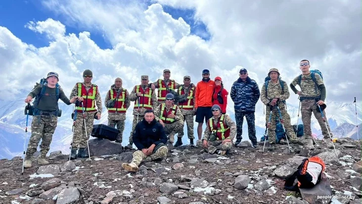
Not only professionals but also relatives of the missing climbers joined the process.
— Katsia, Maksim's wife, flew to Kyrgyzstan and personally participated in the search. Mikalai's younger daughter spent evening after evening analyzing drone footage with everyone. Artur Rubtsou, Siarhei's brother, took on the entire helicopter part from Vilnius: negotiations with the airline, coordination with pilots, logistics, and weather monitoring. He also received financial aid from Lithuania and Europe, which paid for the flight hours.
Viktor Kutsko was assigned a special role in the search. The man had been preparing for the ascent of Kurumdy with the guys, but at the last moment did not go on the trip. He knew their plans best: where camps were planned, how the descent line went, what the group might have been doing on each segment of the path. Therefore, throughout the operation, Viktor worked in close conjunction with drone operators, directing the equipment precisely to the required sectors.
— To summarize, I want to emphasize: mountains are a high-risk zone where even the highest level of professionalism, unfortunately, does not always save from tragedy, — concludes Aliaksandr Smirnou. — Therefore, if you go to the mountains, take a tracker and leave all information with an external coordinator. Invest efforts in advance to increase the chances of a successful rescue in case of an accident.
Now reading


"If there were no BPF, there would be no session. The communists wouldn't have gathered for it." Navumchyk sharply responded to Tsygankov, the "denier."


Comments